Outdoor Air Quality - Ground-Level Ozone |
Ozone is a colorless gas pollutant found in the air we breathe. It is a major part of urban smog. There are two types of ozone:
- Ozone that occurs naturally in the sky about 10 to 30 miles above the earth's surface forms a layer that protects life on earth from the sun's harmful rays.
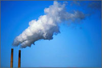
- Ground-level ozone is an odorless, colorless gas that is created by a chemical reaction when pollutants that come from cars, power plants, and other sources come in contact with each other in the presence of heat and sunlight. Ground-level ozone is a regional concern, since the pollutant and its precursors can be transported by wind and travel long distances. Furthermore, it is frequently measured at higher concentrations in rural rather than urban locations because of “ozone scavenging.” Urban environments typically have higher concentrations of nitrogen oxides (NOx) from vehicle exhaust or industrial emissions. NOx is highly reactive and “scavenge” or readily react with ground level ozone, thereby reducing ozone concentrations in urban areas.
Breathing air containing ground-level ozone can reduce lung function and aggravate asthma or other respiratory ailments. Ozone exposure has also been linked with more respiratory infections, medicine use by asthmatics, doctors' visits, emergency department visits, and hospital admissions. Ozone exposure also may contribute to premature death in people with heart and lung disease. People with lung disease, children, older adults, and people who are active outdoors can be affected when ozone levels are unhealthy.
Studies link a wide range of health effects (e.g., lung function decrements, pulmonary inflammation) with prolonged exposures (e.g., 6- to 8-hr) to ozone at levels measured in the ambient air. The current National Ambient Air Quality Standards (NAAQS) for ozone is an 8-hour average ozone concentration of 0.070 ppm. Concentrations above the NAAQS are considered unhealthy, particularly for sensitive groups including people with lung disease, children, older adults, and people who are active outdoors. The outdoor air quality measures for all years are based on the current NAAQS of 0.070 ppm.
- Did You Know?
- Ozone can reach unhealthy levels typically on hot, sunny days. People with lung disease, children, older adults, and people who are active outdoors may be particularly sensitive to ozone.
Ozone outdoor air quality measures are available in a number of formats, including monitored (only) in counties where monitors are located, as well as monitoring and modeled (combined) and modeled (only) for all counties, communities, and census tracts. The outdoor air quality measures for ozone include the number of days in a county that the maximum 8-hour average ozone concentration exceeds the NAAQS during the year and over multiple years (trends) as well as the number of people potentially exposed to levels over the NAAQS. The person-days measure provides information on the number of people exposed to ozone pollution above the NAAQS. When comparing across counties, the highest number of person-days indicates areas with both a large exposed population and a larger number of high pollution days. The number of days when ozone concentrations exceed the NAAQS also provides an indication of short-term "spikes" in ozone concentrations.
- Data Considerations
-
When reviewing and interpreting outdoor air quality ozone data, it is important to take into consideration the following:
- Outdoor air quality measures are available for certain counties where monitors are located.
- Ozone is likely to reach unhealthy levels on hot sunny days. Therefore, the ozone monitoring network operates from March-September.
- Variation in pollutant concentrations within a county will likely exist but will not necessarily be captured by the monitoring network.
- In counties with multiple monitoring sites, the daily outdoor air quality measures are based on the maximum 8-hour average concentration measured in the county.
- Modeled data are used in instances when monitoring data are not available. Modeled data are available by county, community, and census tract.
- Modeled data is intended for planning and research purposes to illustrate ozone trends over time and geography
- Personal exposure and related health risks depend on such factors as the amount of time and level of activity outdoors and cannot be determined solely from outdoor air quality measures.
- Available Data on Outdoor Air Quality Measures for Ozone
-
Use the Explore Maps & Tables link on this page to access the following measures for Ozone in your community. The most current available data will be shown. Be sure to check the site periodically as new data are added each year.
To protect privacy, no information is shown that could identify an individual.
- Number of days that highest daily maximum 8-hour ozone concentration exceeds NAAQS by county
- Number of person-days that highest daily maximum 8-hour ozone concentration exceeds NAAQS by county